 Kentucky : Safety by City
- Ashland
- Bardstown
- Berea
- Bowling Green
- Cave City
- Corbin
- Covington
- Cumberland Falls
- Elizabethtown
- Erlanger
- Georgetown
- Harlan Tri-Cities
- Hazard
- Hodgenville
- Hopkinsville
- Jeffersontown
- La Grange
- Lexington
- Louisville
- Madisonville
- Maysville
- Midway
- Morehead
- Murray
- Nicholasville
- Owensboro
- Paducah
- Perryville
- Pikeville
- Radcliff
- Rosine
- Shelbyville
- Slade
- Somerset
- St. Matthews
- Stearns
Surrounded by the southern edge of Daniel Boone National Forest, you can’t get any closer to nature than Stearns, Kentucky.
Here you can tour the wilderness by train, foot, car, or bicycle.
It’s almost overwhelming to see how much forest is around you when you’re in Stearns.
You also have the Big South Fork National River and Recreation Area to explore.
This is a land where waterfalls, stone arches, and brilliant night skies dominate the landscape.
Stearns and Whitley City are the small towns in this section of the forest, though they hardly feel like traditional towns.
The winding roads and rolling hills make for a peaceful drive and scenic vistas around every bend.
All that is even before you hop aboard the Big South Fork Scenic Railway.
Visitors have several options for overnight stays, from resorts in the woods to primitive camping and various cabin options in between.
While there is something to do in this region every season, a trip here in the fall is unforgettable as the leaves change colors and contrast against the rock walls, arches, and riverbeds.
Along the way, there are great folklore stories with half-truths buried in, like how “Devil’s Jump” got its name.
The story is just as impressive as the river rapids that bear its name.
Warnings & Dangers in Stearns

OVERALL RISK: LOW
There's a low overall risk in this region - IF you are knowledgeable about wilderness and outdoor safety. While there are some nicer spots to stay in, this is the epitome of "connecting with nature" and "roughing it," so you have to be prepared.

TRANSPORT & TAXIS RISK: LOW
You won't find taxis, rideshares, or public transportation here. You'll get here with your own car and get around using your legs. The only time you'll take a load off is when you ride the Big FSouth Fork railway.

PICKPOCKETS RISK: LOW
The traditional pickpocketing and purse snatching don't happen here often, but you do want to avoid leaving your backpack or camping supplies lying around. While theft isn't a huge problem, your goal is to avoid creating a crime of opportunity.

NATURAL DISASTERS RISK: MEDIUM
This is where you need to be careful. A medium-risk exists in every season. Winter brings snowstorms that can be mixed with ice and sleet. While Daniel Boone National Forest is beautiful in the winter, getting to it through the winding and rolling hills can be treacherous. Spring brings severe storm season, and flash flooding becomes a major concern with a risk of tornadoes on top of that. Wildfires can be an issue if there hasn't been a lot of rain the previous winter.

MUGGING RISK: LOW
There was just one robbery in the whole county in 2020, so you can go with this being low risk. One note - there has been an influx of drug crimes in McCreary County. This *can sometimes lead to increased violent crime, such as robberies, so don't let your guard down.

TERRORISM RISK: LOW
You are more likely to run into four bears than any terror risk here. It's a remote wilderness area with a very small population.

SCAMS RISK: LOW
No tourist scams have been reported in Stearns or McCreary County, but if you are approached by someone, you can report it to the state attorney general's office at 1-888-432-9257.

WOMEN TRAVELERS RISK: MEDIUM
This answer really depends on how comfortable and savvy you are about outdoor safety. While I love the outdoors, I'd give this a medium risk for myself because of the risks like slipping on rocks, falling off a stone arch, or running out of water because I'm always thirsty. My best friend Carolyn would consider this a very low risk as she could whittle a rescue vehicle out of a tree and turn river water into drinking water within an hour. I can't street enough how remote this area is, and you have to be able to take care of yourself or your group should any accidents or issues arise. (In my defense, I did survive a 10-mile hike through a Mexico forest where we had to shimmy over the edge of a cliff to avoid a hornet's nest, so she taught me well!)

TAP WATER RISK: LOW
The latest water quality report available from McCreary County goes back to 2020, which is rather uncommon. Most places at least have 2021 posted by now. However, in 2020 there were no violations, and all water met the standards. You definitely want to call the water utility before your visit to confirm this is still the case. That number is (606) 376-2540. For emergencies, call (606)376-2941.
Safest Places to Visit in Stearns
We can’t talk about Stearns without talking about the Big South Fork Scenic Railway.
Tickets are going to cost around $40 per person.
You can add lunch and/or a Barthell Coal Camp Tour for an extra charge.
You must reserve tickets in advance.
The full trip takes about three hours, but just an hour of that is actually riding the train.
If you are visiting during the holiday season, look for ticket prices and hours for the Polar Express tours.
The McCreary County Museum is a great place to visit before you head into the forest.
Here you can learn about the history of the land, former coal mining operations, and the story behind Devil’s Jump.
There’s a fantastic golf course here at Stearns Heritage Golf Course.
As one of the oldest courses in the state, you can enjoy modern-day golfing amenities on a historic piece of land.
There are memberships available, but you can also pay the non-member rates.
You just won’t get a golf cart if you aren’t a member.
Barthell Mining Coal Camp is open for tours, even if you don’t take the Big South Fork Railway to get there.
You’ll get to learn about and tour a mine from 1902.
The camp tours include 16 places to visit, from the miner’s bathhouse to an old-school barber shop to log cabins from that era.
There are cabins here if you wish to stay overnight.
It’s hard to list all the trails, waterfalls, and arches to visit in this region, but some of the top attractions are:
- Cumberland Falls State Resort Park: 30 minutes northeast
- Devil’s Jump Rapids/Overlook: 15 minutes southwest
- Natural Arch Scenic Area: 15 minutes north
- Yahoo Falls: 15 minutes north
- Freedom Church Swinging Bridge: 30 minutes northwest
Places to Avoid in Stearns
You can freely travel throughout Stearns and Whitely City without worrying about dangerous neighborhoods or bad parts of town.
A lot of the dangers that exist here only show their ugly side if you aren’t prepared as a tourist and nature seeker.
For those renting a car, avoid going for the cheapest option.
It’s smart to have an all-wheel drive or four-wheel drive vehicle to tackle the mountain roads and any dirt or gravel roads you come across.
Always keep a weather radio with you and bring extra batteries.
There are a lot of places in this region where getting a cellular signal is going to be challenging.
You have to stay weather aware, so you don’t get trapped by a flash flood, falling tree, or tornado.
Safety Tips for Traveling to Stearns
- Many of the outdoor places to visit have scenic overlooks. Not all of them will have guardrails to protect you from slipping and falling. Especially on top of waterfalls, don’t get close to the edge because the rocks can be very slippery.
- Bring bear spray with you into the wilderness, along with bear-proof food containers. A ziplock bag isn’t going to stop a bear from getting into your food. While it might be amusing to see hungry bears in online videos, it is terrifying when it happens in person. You could also be left without any food or water after the bear wanders away.
- Stay on the trails as much as humanly possible. There are poisonous weeds and plants along with poisonous snakes that could be hiding in the underbrush. Ticks are the problem here, too, so do a full body scan every night and be sure to check your delicate areas. Ticks like to bury themselves in places like armpits and groins.
- For those who want to go fishing anywhere in the national forest or state park, you need a fishing license from the Kentucky Department of Fish & Wildlife. There are no exceptions. Please review all the permits required for certain fish because some require a stamp on top of the license.
- There isn’t air conditioning on the scenic railway train. You can open or close the windows if you’d like, but you must prepare for the potential hot and humid rail car. There is heat in the winter.
- The Catawba Overlook is named for the bright purple flowers of the Catawba rhododendrons plant. While the plant is nice to look at, don’t pick it and certainly don’t eat it. While it’s not poisonous in small amounts, larger amounts can cause a life-threatening illness.
- It’s important to check the river levels in the region before you go ride the rapids. There are some challenging portions of the river, with a Class III-IV drop at Devil’s jump and some Class II rapids. When the river is high, the rapids will be faster. When the water levels are lower, you’ll get a smoother ride.
- When walking on any of the rock arches, there aren’t any handrails or fences. You have to keep children close and don’t turn your back on them for a second. Stay away from the edge, especially if you are prone to vertigo. Just do a simple Google search of people falling in this area, and you’ll see recently, a four-year-old fell from an arch, and a woman fell in the winter of 2022. There are search and rescue crews in the counties here, but it takes a while to maneuver a victim to safety.
- Since you can’t rely on a mobile phone to be your map and compass, bring a waterproof map and a compass. Even if you only plan on hiking during the day, you should pack a headlamp with extra batteries in case you get lost or delayed so you can navigate at night.
- Just because river or lake water looks clean doesn’t mean drinking is safe. There are plenty of resources online to learn how to clean public waters, so they are safe to drink. This is an essential tool when hiking in this area. You should also bring a lighter or matches if you need to start a fire in an emergency. Please follow all the burning rules of the forest.
So... How Safe Is Stearns Really?
The exact crime data from Stearns isn’t available as the McCreary County Sheriff’s Office provides law enforcement in the area.
The crime rates in the country are exceptionally low.
Looking through the past year of crimes posted on social media in this area, drug crimes dominate.
Some of the drug busts came with large amounts of cash and illegal firearms.
There were four car break-ins in 2020 and nearly two dozen “other” thefts, which could be things like stolen items from yards or campsites.
Other safety concerns to study before you go:
- Signs of heat exhaustion/heat stroke
- Signs of hypothermia
- How to stay hydrated without running out of water
- Waterborne illnesses in the region
- Severe weather safety
How Does Stearns Compare?
| City | Safety Index |
|---|---|
| Stearns | 86 |
| Deadwood | 80 |
| Sturgis | 80 |
| Pierre | 81 |
| Spearfish | 80 |
| Hill City | 83 |
| Sevierville | 73 |
| Temuco (Chile) | 31 |
| Puno (Peru) | 45 |
| Nara (Japan) | 88 |
| Kanazawa (Japan) | 83 |
| Hammamet (Tunisia) | 78 |
| Sidi Bou Said (Tunisia) | 42 |
Useful Information

Visas
You will need a visa to visit from outside the United States, which requires an interview with the U.S. Embassy in your home country. Make an appointment for an interview and follow all the required steps to avoid delays.

Currency
You can only use the U.S. Dollar here, but you'll have little use for cash or credit cards in the wilderness. There are stores along the way, and you should assume they won't take credit cards. Always have a reserve stash of cash hidden in your clothing or belongings, but not a large amount.

Weather
Dressing in layers is the smart way to visit an area like this. You'll also want waterproof layers and waterproof hiking boots. Ensure your boots are rugged enough to handle mud, slippery rocks, and winter weather. You need bug spray and sunscreen too.

Airports
You can get to Louisville, Lexington, or Knoxville airports within three hours, but Knoxville is the closest being just two hours away.

Travel Insurance
You should strongly consider travel insurance to protect your flights and any injuries along the way. Make sure your rental car has solid insurance in case of a flat tire or accident.
Stearns Weather Averages (Temperatures)
Average High/Low Temperature
| Temperature / Month | Jan | Feb | Mar | Apr | May | Jun | Jul | Aug | Sep | Oct | Nov | Dec |
|---|---|---|---|---|---|---|---|---|---|---|---|---|
| High °C |
7 | 10 | 15 | 20 | 25 | 28 | 30 | 30 | 26 | 21 | 15 | 9 |
| Low °C |
-5 | -4 | 1 | 4 | 9 | 14 | 17 | 16 | 12 | 5 | 1 | -3 |
| High °F |
45 | 50 | 59 | 68 | 77 | 82 | 86 | 86 | 79 | 70 | 59 | 48 |
| Low °F |
23 | 25 | 34 | 39 | 48 | 57 | 63 | 61 | 54 | 41 | 34 | 27 |
Kentucky - Safety by City
| City | Safety Index |
|---|---|
| Ashland | 78 |
| Bardstown | 89 |
| Berea | 82 |
| Bowling Green | 76 |
| Cave City | 84 |
| Corbin | 85 |
| Covington | 47 |
| Cumberland Falls | 83 |
| Elizabethtown | 87 |
| Erlanger | 84 |
| Georgetown | 74 |
| Harlan Tri-Cities | 89 |
| Hazard | 78 |
| Hodgenville | 86 |
| Hopkinsville | 74 |
| Jeffersontown | 82 |
| La Grange | 87 |
| Lexington | 78 |
| Louisville | 65 |
| Madisonville | 82 |
| Maysville | 85 |
| Midway | 86 |
| Morehead | 86 |
| Murray | 83 |
| Nicholasville | 78 |
| Owensboro | 78 |
| Paducah | 56 |
| Perryville | 88 |
| Pikeville | 88 |
| Radcliff | 88 |
| Rosine | 90 |
| Shelbyville | 86 |
| Slade | 68 |
| Somerset | 86 |
| St. Matthews | 82 |
| Stearns | 86 |
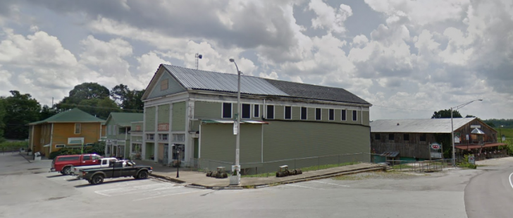

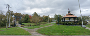
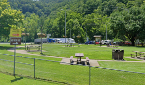



I’ve been traveling to Stearns for years, and safety has never been a concern. Whether you’re hiking in the national forest or strolling through downtown, you’ll feel at ease knowing you’re in a welcoming and secure environment.
Stearns may be a small town, but don’t let that fool you! It’s one of the safest places I’ve ever traveled to.